![]()
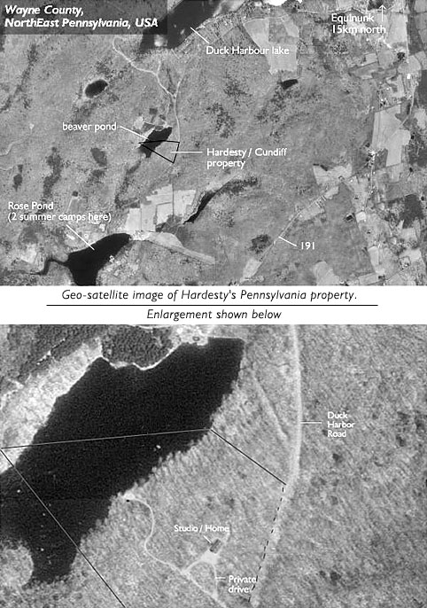
| The top geo-satellite image is roughly one sqaure kilometer. It's primarily wooded land. Darker patches are water, lighter patches are mown fields. The second image is a close-up of Hardesty's 15 acres which abuts and partially includes a 20-acre beaver pond (dark area). |
![]()